
It had been a year since I had last been down to Florida to visit my Dad, so I arranged for some time off at work in order to make what was now becoming my annual trek to the sunshine state. I started making plans and it appeared that everything except the weather was going to cooperate.
There was a front bringing some rain and possibly storms to the south were forecast for the week-end I was heading out and by all indications I was going to get wet at some point along the way. I've often said that if you don't ride in the rain, you don't ride much at all. Lord knows that Julie and I have lots of experience riding in rain gear but I wanted to avoid as much of it as possible, especially considering that the forecast mentioned the possibility of violent storms.
As the week-end approached the forecast was shaping up so that the band of storms would be coming through South Carolina on Friday night and hit North Carolina on Saturday morning. Julie and I both were looking at it and figured that if I left the house on Friday afternoon I could get to South Carolina and a motel before dark and ahead of the storms and let them pass through in the night. Then Saturday morning I should be able to leave and at the most deal with some wet roads. Julie was able to secure me a room at a Hilton in Orangeburg, South Carolina using her motel points, so it was officially a plan.
Leaving work about lunch time on Friday I was on the road by early afternoon. I was actually feeling good about having plenty of time in which to make the trip and looking forward to doing some 'flower sniffing' along the way. I hadn't been on the road very long at all and was already wishing that I had put some more layers of clothes on because even in early April it was still a little on the cool side once I got rolling. Taking my cue from Julie I saw an old abandoned building on the side of the road where I could stop and put on my thermals. Yes sports fans, behind this old gas station I stripped down to my skivvies so that I could get into my long johns. Hey, it worked and I spent the rest of the day very comfortable thank you very much.
Despite being in no particular hurry and just easing along I was still making pretty good time and by my calculations would be in Orangeburg by supper time. With that in mind I began trying to remember what restaurants were close by the hotel and trying to decide where I wanted to eat. Before long I found myself on the south side of Kershaw, South Carolina wondering if anything would be going on at the road racing facility there. As I rode past it I saw cars out on the track and decided that since I had time to kill I would turn around and check it out.
There was a perfect spot for viewing the highway side of the course just off the road so I pulled over and found a place to park the bike. At the time there were some basically street stock import class cars out on the track making more noise than anything else, but it was mildly entertaining so I figured I'd stretch my legs and watch for a bit, then ease on down to the hotel. It was only a couple of hours away after all.
The noisy little imports made several laps and then stopped and for a while nothing else came out on the track. I was just about to saddle up and head out when I heard the unmistakable sound of a racing V8 being warmed up. Hmmm, maybe I'll hang around a bit I thought to myself. In no time at all there were several Corvettes and Porsche's on the track and after a bit a couple of LeMans style prototypes joined them. Hot damn! Now we're talking! It appeared to be either a practice session or maybe they were tire testing, I'm not sure, but it was definitely not a race. None the less most of these cats were hauling the mail! From my vantage point in the cheap seats I could easily see flames coming from the exhaust pipes as the cars entered a braking zone. It was cool as heck and I was enjoying myself immensely. I got so completely caught up in it (I'm a gear head and race fan, what can I say?) that I completely lost track of time, and by the time I figured that out (when the cars pulled off the track...) more than two hours had passed! Uh-oh. Got to go.
Checking the map before I left I found that I had about one hundred miles to ride to get to Orangeburg, which would take me a little under two hours to do. Except that I was pretty sure I didn't have enough fuel to go that far and would probably have to stop before I got there. It also was pretty obvious that I wouldn't make it before dark.
*sigh* Oh well...
After making my fuel stop I rolled into the hotel parking lot about 7:30 pm or so. A little later than I had planned, but hey, I had a good time and that's what the trip was all about, right?


The Nomad in full tour mode just off US 301 in South Carolina, in a few minutes we would be very wet...
When I got up the next morning the first thing I noticed was that it hadn't rained. Not a drop. A quick check of the Weather Channel on TV revealed that the front had stalled and the storms would be rolling into Orangeburg later in the morning!
Oh noooo! I would be riding right into them!
I hurried through breakfast, then packed up and loaded the bags on the bike. Thinking ahead I put my rain pants and jacket where I could get to them easily and quickly when needed. I topped off the fuel tank and then put the Nomad in the wind. As I flew down US 301 I couldn't help but think how comical the situation was. The motel in Clewiston didn't have a room available until Sunday afternoon which meant I would be spending another night on the road and I was riding hard into a rain storm. My logic, flimsy as it was, had me making as much time as possible so that when I hit rain and had to slow down I would have more time to deal with it.
Around Bamburg, South Carolina the sky really started to look bad so I found a spot just off the road to stop and gear up for the impending rain. Once I got moving again it wasn't long before it started, but at least it was just a light rain. When I got to the Georgia Welcome Station it was raining steadier and harder, plus the further south I went, the worse it got and on top of that the wind was picking up.
By the time I got to Statesboro, Georgia I felt like I was in a monsoon. I'm not really sure if it was actually raining all that hard or if it was just that the high winds made it seem that way. Rolling into Glennville, Georgia I was looking for someplace, anyplace to stop and get out of the weather. I was beat up and tired and seriously thinking about calling it quits for the day. Temporary salvation came in the form of a car wash facility that was made out of concrete blocks but with a metal roof, I pulled into one of the bays to take a break and figure out what I was going to do next.
The wind was blowing in gusts that made the roof of the car wash creek and moan, but now out of the rain I could see that it was raining steady, but not near as hard as it seemed when I was riding. In the immediate area there wasn't a motel to be seen so it was a given that I was going to have to ride some more. I'd been there for a little while when to my surprise the winds died down and the rain let up so I quickly saddled up and headed out again, hoping that maybe I was through it.
You've heard the saying "The calm before the storm"? Uh-huh. Things were about to get ugly...
From there to Ludowici, Georgia it rained but not bad, and the wind wasn't bad except for the occasional gust that would hit me and actually move the bike over. But all things considered it wasn't too bad. I fueled in Jessup, Georgia then set out again thinking that eventually I had to run out of this slop and mess.
If you look at a road map of Georgia and find US 301 you'll see that from Jessup to Folkston there isn't a whole lot to be found except countryside. The road is loooong and straight for miles. In places the road bed itself is only inches above ground level and in some spots it's actually lower causing water to stand and sit when it rains. Once again the further south I went the worse it got, but now I was in the middle of nowhere and had no choice but to continue. At times the wind was gusting so bad that it would literally blow me across my lane and almost into the on coming one. Even when it wasn't gusting it was steady and strong enough that I found myself having to lean the bike into it at a very exaggerated angle to simply go straight on. My face shield was helpful in that it kept the rain from beating me in the face, but it was so covered with water that it was hard to see out of, which caused me to lift it for a while causing me to have to shield my eyes with my left hand, then close it again so that I could put my left hand back on the handlebars. It wouldn't have done me any good to stop because I would have been sitting in standing water, getting rained on while the wind blew.
I'm really not sure exactly where what I'm about to tell you happened, just somewhere in the middle of BF, Georgia on US 301. Suddenly the wind and the rain picked up dramatically. I'm talking about what seemed like hurricane force winds and rain hitting my helmet so hard it made my ears ring. To be honest I'm not real sure how I even controlled the motorcycle but I remember letting up off the throttle and thinking that I might have to stop. As I looked off to my right, which would have been due west I saw what appeared to be a wall of rain in the form of a very dark sheet. I glanced at the road again, then looked back towards where the sheet had been and saw a tornado!
In what seemed like forever but in reality was probably only a mile or two, the wind and rain let up considerably, when I reached the US 1 and US 301 split it had quit entirely. I rode on into Folkston and pulled off at a truck stop, filling the tank and then going inside for a cold drink. While inside I overheard the ladies at the fuel desk saying that there had been two tornado's that had caused a considerable amount of damage just a few miles north. Back outside I came out of my rain suit and just sat on the sidewalk next to the Nomad for a while, collecting my thoughts. A car pulled up and parked next to me. The driver, an elderly man, went inside and came back out a few minutes later.
"If you're going that way" he said motioning north bound, "You might ought to think about waiting a while."
"I just came from there." I said.
He stood there for a long second, then said "You're lucky to be alive young fella." patted my shoulder, then got in his car and drove off.
I think I agree with him...
A few minutes later I got on the bike again and rode into Baldwin, Florida, checked into a motel and got something to eat. Before I went to bed it started raining again.
It was still raining when I woke up the next morning. I walked up to the lobby and ate breakfast, then went back to the room and waited until close to check out time hoping the rain would stop, It didn't. So I loaded up the bike in the rain, then put my rain gear back on and literally stepped out of my room into the rain, onto the bike and headed out.
The rain continued until just north of Orlando, Florida, then the clouds broke and a hot Florida sun came out. Gawd it was muggy... Close to Frostproof the wind started to pick up and by the time I got to Sebring it was blowing almost as hard as it had been in Georgia before I saw the tornado. It continued to blow like that all the way to Clewiston.
It was late afternoon when I got to the motel and checked in. I parked the bike on the walkway directly in front of my room, took off the bags and went into the room and sprawled out on the bed. I've always said that no one loves to ride a motorcycle more than I do, but that afternoon I had enough. I wanted off that bike and didn't want to get back on it for a while.
Close to dark I got off the bed, took a shower and walked up to the restaurant at the marina and got a bite to eat. Then went back to the room and got back in the bed. That night I slept the sleep of the truly weary, I don't think I even rolled over the whole night.


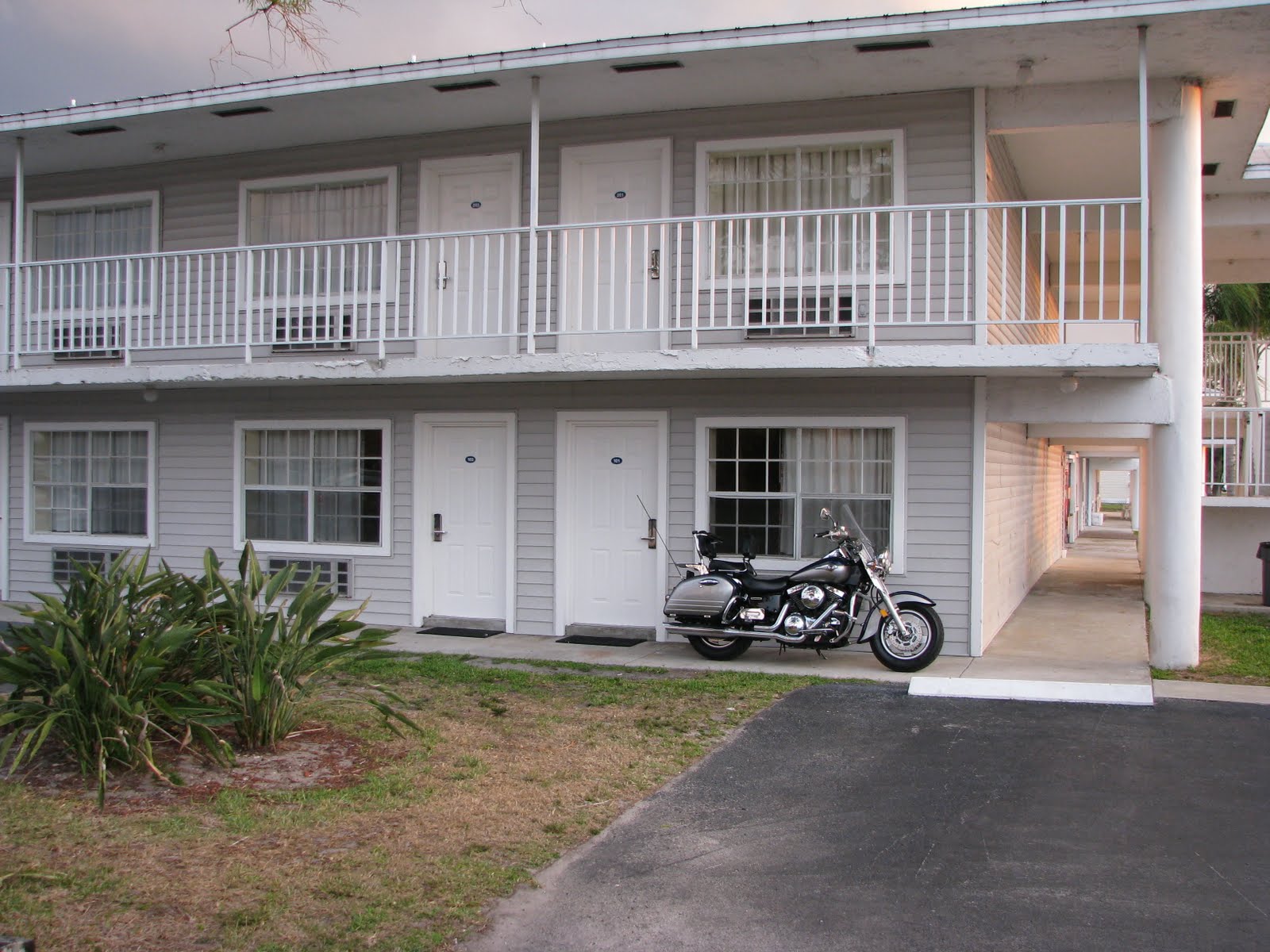
My home away from home while in Clewiston - Roland Martins Marina and Resort.

Sometimes the Nomad looks out of place.


Some of these bass boats would be fighter planes if they had wings.
Of course the main reason I ride to Florida is to spend time with Dad. For the most part we sit in the living room or on the porch and I listen to Dad's stories and we catch up from my last visit. Usually we will get out and ride around in his old truck at least one day while I'm there and this time was no different. But I had a plan, I wanted to go and "check the pumps".

Joseph Beecher "Joe" McCrary - My Dad
When he got out of college Dad went to work as a farm equipment salesman and was with two different companies, J.I. Case Company who made tractors and implements and Lovette and Thorpe, a farm implement and supply distributor out of Dublin, Georgia.
He grew tired of being on the road and in 1968 he answered a classified ad in the Tampa Tribune from the South Florida Conservancy District in Belle Glade, Florida. They were looking for an engineer and general manager for the drainage districts that were being reformed in the area. He got the job and moved us from Frostproof to Belle Glade and then in 1970 to Clewiston once the division of the districts was complete as well as his office and our house were built.

The offices of the Clewiston, Sugarland, Ritta, Diston Island and South Shore Drainage Districts as it is today.
Up until the early 30's south Florida was basically just swamp land, but after two devastating hurricanes the U.S. Army Corps of Engineers set out to build a levee, or dike as we called it, around Lake Okeechobee in an effort to control the waters of the giant lake as well as to make the lands in south Florida more accessible and usable. The federal government in the form of the Corps of Engineers aided in the original building of the main canal systems that had to be built in order to drain the land and control the flow of water, but the individual land owners were responsible for building and maintaining the secondary canals and drainage ditches that actually made specific tracks of land ready for farming and habitation. This was done up until the late 40's when it became obvious to all involved that something better was needed and at that time the first "Drainage Districts" were formed. These were funded, managed and run by the state, but answerable to the land owners in the form of a board of directors. These districts grew and expanded over time with the last of them becoming a reality when Dad was hired and put into place in 1968.
To say that my Dad had a huge impact on the local area would be an understatement. The thing is his work went unnoticed by most people, all they knew was that they weren't floating away during storms or still had a stable water table during droughts. Mom used to say that Dad was "A big fish in a little pond" and that was true to an extent. I just don't think she really ever understood that the pond was as big as Lake Okeechobee.
For him it was a huge undertaking filled with long hours, frustration and hard work. For me, a pre-teen, teen and young adult during his career with the districts, it was one cool experience after another and I don't think that he really knows to this day how much I enjoyed it or how much of an impact it made on my life. To him I'm sure he felt like he was just grabbing some cheap help in the form of his kid, or making sure that I wasn't out getting into trouble. To me it was not only one adventure after another, it was being able to spend time with my Dad and seeing him in what I now realize was his element and at his best.
There were big and exciting projects such as the building of new pumping stations or the rebuilding and updating of existing ones, the re-routing or enlargement of canals (Which by the way, you can't imagine how cool it is to see a one mile section of canal dynamited in order for heavy equipment to get in and dig it out!). There were a couple of fires at pump stations that caused catastrophic damage resulting in massive re-building projects that had to be done in an unbelievably short amount of time so that the impact on water levels and tables would be minimal. And there were rain storms, tropical storms and hurricanes that had us out at all times of the day and night starting and maintaining pumps, opening and closing control gates all the while running around like a bat out of hell in the middle of all of it to get from one point to the next.
It was great!
But for all the excitement it was the day to day things that went on that kept the whole area on an even keel water level wise. And the main part of that was what we always called "Checking the pumps" where we quite literally rode the entire district(s) checking over the pump stations, the control gates and the water levels at each of them making sure that everything was as it was supposed to be. I think really I enjoyed this the most. I was actually employed (as opposed to being free child labor) by the Drainage Districts for close to a year just before Julie and I were married. One of my favorite memories is of her getting out of bed before daylight on Christmas morning to go and check pumps with me.
Dad retired from the Drainage Districts many years ago but with as big a part of our lives as it was we still find ourselves talking not only about the old days, but interested in and concerned about them today.
So on this particular day, camera in hand, we got in Dad's old pick up and headed out for the sugar cane roads and back roads to "check the pumps" one more time.
What we found amazed me and disgusted Dad. For the most part the canals, pump stations and equipment were in a shambles. I can't tell you how many times I said "If you would have seen this when you were in charge somebody would have been in big trouble!". After he retired his districts went back under the control of the South Florida Conservancy Districts in Belle Glade. Shortly there after budgets were cut so man power and money to maintain all the districts, not just his old ones, ran short. Eventually some control and responsibility was given back to the individual land owners who have more to worry about (they think...) than pump stations, canals and their upkeep and maintenance.
Dad said at one point, "I guess it's come full circle now." I can't help but agree and will add that at some point in time history will repeat itself again during a hurricane or tropical storm and the people of the area will wonder why things were allowed to get in such foul shape.

Sugarland Drainage Districts main canal.


Sugarland pump station showing the results of years of neglect.

One small diesel engine lacking upkeep and one pump tube is all that works now.


Fairbanks-Morse diesel engines
These two Fairbanks were operational while Dad ran the districts and they were awesome to hear while running, you could almost count each cylinder as it fired 380 times a minute. Boom boom boom boom boom - when the wind was right I could hear them from our house, two miles away.

Pump tubes capable of moving 40,000 gals per minute each. Sugarland had three, the third powered by a more modern Caterpillar diesel engine.

One of the tubes had a cover removed, this is the impeller shaft inside.


Sugarland is primarily an irrigation station these days and is incapable of moving large volumes of water.

How deep is the water?
The photo above shows a water level gage. They show the level of the water in relation to sea level, not actual depth. See the black mark that has the point at the top next to the number 12? That is 12.0' or twelve feet exactly above sea level. Each side of those black marks represents a tenth of a foot. The bottom of that same mark is 11.9', the top of the mark below that is 11.8'. The one with the point on the bottom is the .5' mark. This reads just under 11.2'. When we were actually checking pumps we carried a log book with us where we recorded each of these readings. We did this once a day, 7 days a week, 365 days a year, rain or shine.


Leaving the Sugarland pump station and riding through the sugarcane fields toward Diston Island Drainage District.
These were the types of dirt roads I learned how to ride a motorcycle on. I would ride them for miles and miles and could reach neighboring towns with out ever getting on a paved road.

The canal feeding the "East End" pump station.
Notice the vegetation, this slows down the flow of water and can get to the pump station causing more water flow interruptions. I spent many hours behind a tractor pulling a spray rig putting out herbicides to keep this type of growth under control.

Diston Island Drainage Districts "East End" pumping station.
Dad determined the need and location for this pump, then designed it, drew up the plans and supervised it's building. It had three 'high revving' (2100 rpm) diesel engines made by Detroit Diesel. He hated those engines but was forced to use them as they were the low bidder on the project. Within a couple of years of it's completion one of the fuel lines broke while the engine was running causing the station to catch on fire and burn almost to the ground. Due to his design and specifications using a steel building with removable steel supports with concrete base and floor the station was completely rebuilt in less than a week. Caterpillars replaced the Detroit's this time...

Uh-oh, someone needs to pull trash.
Vegetation and various floating debris could get so thick during long runs that it would cause a drop in the water level from one side of the rack to the other. Long handled pitch forks were used to pull the trash off the racks and then piled onto the walkway where it would be shoveled onto the back of a small dump truck and hauled off. Guess who used to have to pull trash during rain storms?

The discharge or "lake side" of East End.
Although some of the pumps were capable of moving water in either direction, most could only pump water out of the district. For irrigation purposes those stations were built with culverts and control gates in the stations foundation which when opened allowed water from the lake to flow into the district. The pumps at East End are relatively small compared to the older stations and move only 15,000 gallons per minute each. This was fine for the job this station had to do.

One of the U.S. Army Corps of Engineers pumping stations on the levee surrounding Lake Okeechobee. East End pumped water from the east side of the Diston Island Drainage District to this station.

Diston Island #2 pump station.

Dad checking out the recently added irrigation pump. The service truck belongs to Kelly Tractor Company who had a man there replacing a leaking engine oil seal.

Intake side of station.

Discharge side of station. There used to be a walkway around the station there.

This canal follows the levee back to the Corps of Engineers station shown earlier.

Looking the other way.
Going this direction this canal intersects the discharge side of Diston Island #1 pump station which is about four miles away, then flows into the Caloosahatchee River in Moore Haven. The Caloosahatchee flows from Lake Okeechobee to the Gulf of Mexico. There is a huge set of culverts and automated gates directly behind both the #1 and #2 stations that allow water to flow directly in or out of Lake Okeechobee.

A small 'gator swimming around in the canal.

The doors were open and our names are J.B. McCrary after all, so we went on in.
Dad started telling the tech in the photo that the station was in poor shape compared to when he ran the districts. The tech actually stopped him mid sentence and asked if he was Joe McCrary, Dad grinned and said yes, the tech told him that he had heard a lot about him over the years and was proud to be able to meet him. How about that?

The tech didn't say, but I'm pretty sure it was the front seal he needed to replace...
In Dad's day we would do most repairs in house farming out very little work to outside vendors. As a matter of fact, years ago one of the engines at this stations sister, Diston Island #1, broke a connecting rod kicking the broken pieces through the engine block. Naturally during the middle of a rain storm. With the other engine running wide open right next to us we pulled the heads and oil pan off the broken down engine to begin repairs. As some of us removed the broken pieces others ran to Kelly Tractor to get the parts needed to fix it. Long story short we replaced the damaged parts and using the pieces of the engine block that were usable along with some heavy duty epoxies we repaired the damaged engine block. All in less than 12 hours. Dad said when he retired that engine was still in service, ran fine and never leaked a drop of oil.

Left side of engine.
The gages are a tachometer, hour meter, oil pressure, oil temp and water temp. The long cylindrical thing with "CAT" on it is one of the fuel filters and although it's hard to see it, the throttle is just below it.

Right side of engine.
The rusted looking part is the engines turbo charger and exhaust pipe. These things get incredibly hot, so much in fact that they glow. I've been in this station at night with both engines running wide open and could see well enough to walk from just the glow of the turbos.


Ugh! Nasty!
The floors, pumps and mounts all used to be painted the 'Battleship Gray' that the tube on the left is painted and were clean and spotless. It broke my heart to see the station like this. The pipes on the floor are actually coolant lines. The engine cycles water from the pump bay through a series of filters then into it's cooling system. This allows it to have a constant supply of cool water and does away with the need for a radiator and fan. These pumps are the same size as Sugarland, but a little more efficient and can each pump around 50,000 gallons of water per minute.

Gravity Flow Gate.
On the far side of the photo is the discharge tube of the irrigation pump, the board covering it is to keep 'gators and turtles out. The tall thing in the foreground is a gravity flow gate attached to a culvert that goes under the road to the canal on the other side. The water level can be controlled by the height of the planks in the gate, as the level of the water rises it spills over the top of the boards and flows into the other canal. They must want the water level to rise way up before it spills over!

12.3' on the discharge side.

10.0' on the intake side.

There is only one pump station in the Ritta drainage District, but it is the largest and one of the oldest pumps in all of the districts.
The Ritta pump station was built in the mid to late 40's and is located south of the old Ritta locks on the Miami canal. When originally built it had three Fairbanks-Morse diesel engines similar but much larger than those located at the Sugarland pump station. The pump tubes at Ritta are huge, each having having a diameter of 48 inches and can move more than 80,000 gallons of water per minute. Two of the Fairbanks engines had been replaced with Caterpillar diesels by the time Dad got there, but the one that was left was actively used until 1991. That engine now sits as an historical monument at the John Stretch Park in Lake Harbor, Florida.
As was the norm during the time that Ritta was built, there was a house on site for the operator of the station. Back then there wasn't a lot of housing available period so the districts used the available housing to attract and keep operators. In addition the Fairbanks-Morse engines needed almost constant supervision in order to keep them operating.
When Dad came on board with the districts the house was used as a perk for long term employee's. At the time a man named "Tom" was living there and had been the operator at Ritta for more than 20 years if memory serves. Tom was a tall lanky fella that had a great sense of humor and a wealth of knowledge about the districts. For whatever reason Tom and I hit it off and whenever we were at Ritta I usually shadowed him. One rainy afternoon we were pulling trash off the trash rack with all three engines running behind us. All of a sudden Tom dropped his rake and ran off towards the pump station. The site of that tall, long legged man running a full stride was a site to see! Naturally I took off after him, but couldn't keep up. Dad had also seen him running to the station and we both got in the station about the same time and found Tom shutting the lone Fairbanks-Morse engine down. Dad ask him what was wrong and Tom told us that he heard the engine lose oil pressure and had to shut it off before it destroyed a bearing. He looked over the engines oiling system for a few minutes and found a blocked oil line. There was a replacement in the storage box inside the station and within a few minutes he had it replaced, the engine running and the pump back on line.
When Dad came on board with the districts the house was used as a perk for long term employee's. At the time a man named "Tom" was living there and had been the operator at Ritta for more than 20 years if memory serves. Tom was a tall lanky fella that had a great sense of humor and a wealth of knowledge about the districts. For whatever reason Tom and I hit it off and whenever we were at Ritta I usually shadowed him. One rainy afternoon we were pulling trash off the trash rack with all three engines running behind us. All of a sudden Tom dropped his rake and ran off towards the pump station. The site of that tall, long legged man running a full stride was a site to see! Naturally I took off after him, but couldn't keep up. Dad had also seen him running to the station and we both got in the station about the same time and found Tom shutting the lone Fairbanks-Morse engine down. Dad ask him what was wrong and Tom told us that he heard the engine lose oil pressure and had to shut it off before it destroyed a bearing. He looked over the engines oiling system for a few minutes and found a blocked oil line. There was a replacement in the storage box inside the station and within a few minutes he had it replaced, the engine running and the pump back on line.
Because of it's location so close to US 27 not to mention the house and the pumps long history with the districts Ritta was always like a 'show piece' to Dad. We had to keep it freshly painted and spotless at all times. I can't even begin to count the number of hours I've spent cleaning the floors, walls, engines and pump tubes there even the outside of the building was painted once a year. It was almost painful to see it looking like it did when we pulled up.

Rita Pump Station.

The two 'EPA legal' fuel tanks were added after Dad retired.

At least the trash rack is is good shape.


Pumping water out of the district with the center pump.

Empty fuel tank saddles.
Dad always bought fuel for the districts in bulk. He would send out bids to multiple fuel distributors for many hundreds of thousands of gallons at a time. This helped to get fuel cheaper and by keeping so much fuel on hand at any given station we were never worried about running out. The amount of fuel kept at each station varied with each location and was based on many factors. Ritta had a fuel capacity of 25,000 gallons.

Dad looking disgusted with Ritta's appearance.
It was really our lucky day because when we got to Ritta it was pumping water and the guys with the South Florida Conservancy District had left the south side doors open. Once again, since we were both J.B. McCrary we helped ourselves to a quick inspection of the inside of the station. While not really up to Dad's standards it was at least in much better shape than the outside.

Spare impeller shaft with impeller attached, and a spare impeller on the rack.

Another shot of the impeller rack and inside of the station.

Vacuum pumps.
All of the older big stations that used the Fairbanks-Morse pump tubes required priming before they would begin to pump water. At stations like Sugarland and Diston Island the impeller shaft was close enough to the water that using an air compressor to evacuate the tubes would suffice, but Ritta had such large diameter tubes and the intake was so far below the impeller that specially built vacuum pumps were required. Powered by V4 Wisconsin brand engines, these vacuum pumps would be fired up and allowed to start pulling a vacuum before the main engines were fired and the pumps engaged. It usually took about five minutes of both the vacuum pump and the main pump running before the pump tube was primed and water was flowing through it. You could tell that the tube was primed by the sound of the main engine, as the massive load of water hit the impeller the big diesels would literally moan and drop a few hundred RPM. At that point a valve on the vacuum line would be shut off and the vacuum pump along with the V4's would be shut down.

This was my first time seeing all three positions occupied by Cat engines. The old Fairbanks-Morse sat on the left side of this photo up until 1991.


900+ cubic inch, turbocharged, 500 hp, 6 cylinder Cat diesel engine.

8.5' on the intake side.

11.0' on the discharge side.
All of the previous stations were located in sugar cane fields and their primary role was to maintain consistent water levels during normal times and emergency water evacuation during storms. Now we'll look at the stations that keep the town of Clewiston's water level under control.
There are two pumping stations in the Clewiston Drainage District and they are numbered 2 and 3 respectively. The #1 station was torn down and has been gone for many years now. It was one of the first stations built in the area, was constructed of wood, resembled a house in its construction and was positioned on the west side of town and just south of the Clewiston locks and the levee on what is known as the industrial canal. To be honest, when Dad came on the scene it had seen it's better days. The structure was not in the best of shape, it was capable of pumping water but the engines leaked oil and required almost constant maintenance and the pump tubes themselves were loosing efficiency. This combined with the fact that 'civilization' had caught up to it in the form of fishing marinas being located close by spelled doom for the aging station.
CDD #2 was built in the mid 60's to augment and hopefully replace #1. Dad said from the very beginning that Clewiston would need at least two stations capable of moving fairly large quantities of water in order to keep it safe during heavy rains and storms. He didn't feel that #2 alone would be able to move enough water in the amount of time needed to prevent flooding.

The canal feeding CDD #2 pump station.
Dad's house is less than a half mile from here.


Intake side of Clewiston Drainage District pumping station #2.


Side and rear views.

Discharge side canal.
The trees in the background are on the levee surrounding Lake Okeechobee.

Automatic switch controls.
The automatic switches at #2 are set up to keep the water level in a predetermined range. As the water level rises to a certain point the pump engines crank by themselves and begin pumping water, once the water level is drawn down to the specified level they automatically shut down. It works fine in theory but Dad never seemed to trust it so we seldom, if ever used it.
With this station being so close to the house it was always the first stop for Dad and I during a storm. After a while Dad's confidence in my knowledge and understanding of the systems and that station in particular grew to the point that on week-ends or holidays when advanced notice of rain or storms were available he would send me by myself to start it. But as a rule, when bad storms were at hand Dad and I were usually together in his car, riding all over the districts keeping an eye on things.

12.8' on the intake side.

11.1' on the discharge side.
In the mid 80's a developer became interested in buying all of the smaller marinas located next to the levee as well as a lot of the adjacent vacant properties in Clewiston. This developer wanted to build a modern facility that would include condo's, a motel, restaurant and RV sites. The problem was that these plans did not include the #1 pump station, so the developer and the city came to Dad to ask what could be done. By now the station was in pretty bad shape and only used when necessary, and in all honesty Dad wanted it gone too. He had already been working on two plans, one was the total rebuilding of the existing station, the other a replacement in another location. The costs involved being the deciding factor. When it was all said and done it was decided to tear down #1 and build a brand new facility, Clewiston Drainage District #3. By the way, the developer turned out to be Roland Martin and eventually the Roland Martin Marina and Resort was built.
This station was to be Dad's last big project with the districts and while we were out this time looking things over and taking these pictures it seemed to be real important to him that we stop by #3 and look it over. "You're the only one that will take me to see these places" He said, "and I don't know when I'll get back." We stayed there as long as he wanted...
The station was actually built after Julie and I had married and moved away, but I had been involved in it's planning. Dad and I walked the canal it was to be built on many times and surveyed potential locations until the spot it now sits on was decided upon.

The canal feeding CDD #3.


The intake side of Clewiston Drainage District station #3.

The discharge side.


Discharge side canal, actually the southern end the industrial canal.

12.6' on the intake side. The discharge side was unreadable.
Checking the pumps requires spending a lot of time in the sugar cane fields and on the roads used by the growers to access their fields. While I was growing up it was seldom that a locked gate was encountered and if one was found to be locked the district had keys to them all. Times have changed though and on this day we saw more locked gates than open ones and not a single key between us. Still, some of the cane roads are really artery's that provide access to more than one growers property and have multiple access points, these roads weren't gated or locked so we were able to ride down them. This provided me with a chance to photograph some of the equipment used to harvest sugar cane and get it into the mills.
Once sugar cane has matured and is ready for harvesting fires are set in the fields in order to burn off the foliage and underbrush. In the old days this was so that immigrant labor from places like Haiti and Jamaica could get to the stalks of cane, cut them with machetes and then pile it up. Field loaders would then come in and load the cut stalks into wagons pulled by what essentially were bull dozer's with monster truck style wheels and tires on them that we called "sugar babes". Each tractor pulled four wagons, and once they were loaded they would go to rail road or truck lift loaders where the cane was then loaded onto rail cars or semi trailers and then hauled to the mill. Now days the Haitians and Jamaicans are no longer needed as mechanical harvester/loaders, not unlike those used to cut and harvest corn and wheat, are used after the burning. The cane is then loaded into wagons or trucks and taken either to a rail lift station or directly to the mill, depending upon the size of the farm and the growers preferences.
There are two types of lift loaders, portable ones that can be moved from location to location by tractor and with out too much trouble. These are capable of loading rail cars or semi trailers and favored by the smaller growers. Then there are the huge permanent ones that are structures in of themselves, usually only load rail cars and belong to the big growers.


Multiple views of a portable lift loader.


Multiple views of a permanent site lift loader. This one is at "Liberty Point", the site of a POW camp in WWII.


Semi trailers used to haul cane from the fields to loaders or directly to the mill during the harvest of sugar cane.
After a week of visiting it was time to head back to North Carolina. I'm extremely pleased to report that the trip home was much, much less eventful than the ride down was. In fact, it was quite pleasurable. This time I made the trip in the usual two days, stopping the first night in Waycross, Georgia at a Holiday Inn Express that Julie was able to get for me using her motel points. Score!
I left Waycross and took US 84 north to Jessup so that I could get back on US 301, my normal and the closest route home. For the most part I rode from fuel stop to fuel stop and only took the camera out once, just north of the Georgia Welcome Station.
The Georgia/South Carolina state lines are marked by the Savannah River, with a sign on either side of a rather high and large bridge welcoming you to each state. Years ago the bridge on the old road was a swinging bridge that was rotated out of the way when barges or large marine traffic came through. On every trip to Florida and back I have wanted to stop to check it out, but just never have. This time I did.


The swinging bridge on old US 301 over the Savannah River.
All along US 301 are reminders of days gone by, when US 301 was a major north/south route through the south. This bridge is just another one of those tributes to the days of motor courts and travel centers. Before the interstates changed not only the way we travel, but the face of the country side as well. As the pictures show it was kind of sad and eerie, yet beautiful at the same time.

Loaded up and heading home.
I guess that the time I spent as an over the road trucker where interstate travel was the preferred and most times required method has made me want to see another part of America when I travel by motorcycle. Not only are these back roads less traveled and populated, to me they are more scenic, more relaxed and just a more enjoyable way to travel. Sure, it takes a little longer to get somewhere, but that's exactly the point, and why we call it " flower sniffin' ".

1680 miles for the round trip, and still it ended too soon.
Bruce


